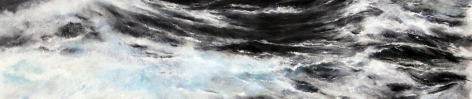

Painting of whitecapping surface waves “Bound for the Skerries” by Janette Kerr. 115x190cm, charcoal, chalk, graphite on canvas. The painter connected with wave researchers to bring about a series of artworks that relate art and science. http://extremewavetheory.blogspot.no/
A big winter storm is brewing in the North Atlantic. Meteorologists on TV exclaim that there is a developing storm system just south of Iceland, and that the current position of the polar front will most likely steer the low called “Gertrud” towards northern Norway. While a TV correspondent in Reykjavik reports of the most recent storm damage, people in coastal communities of Norway and Scotland are getting alarmed: If the storm moves to northern Norway, the entire coast will be affected along its way before Gertrud hits land. While mountain people tie down everything that’s loose, harbor towns are not only concerned about the wind – it is the rising water level and large ocean waves that’s causing them headaches. Fishermen started to secure their boats and managers on offshore rigs consider to evacuate their platforms. Now everyone wants to know more detail: how much water is going to pile up, and how big is the largest wave going to be?
The path of low pressure Gertrud is predicted by computer simulations that forecast the state of the atmosphere – we get a prediction of how much wind to expect and where it is going to rain, based on physical laws describing atmospheric flow. But this atmosphere model isn’t telling us what the ocean is doing, even though storm surges and waves are ultimately caused by wind blowing over the ocean’s surface. In addition to the weather prediction model, an ocean model is used to forecast ocean currents and sea level, in the same way as the atmosphere model forecasts wind and air pressure – just with water instead of air. Both models are connected: The atmosphere model tells the ocean model how the wind is blowing. If wind is blowing towards land for a long time, water will pile up at the coast and and coastal communities know whether it will be necessary to secure dikes with sandbags or not.

Small fishing boats near the Lofoten peninsula, relying on wave predictions for their safety. Photo by Kai Håkon Christensen.
For everyone offshore, a prediction of wave height is crucial for safety. Wave information are also for needed search and rescue drift forecasts (Study on waves and forecasts). Wave forecasts (yr.no, click on location on map) are different from atmosphere or ocean forecasts. Although they are located just in between, they aren’t included in either atmosphere or ocean models because waves are much smaller than features like low pressure systems or oceanic current whirls. More than that: waves are much too small and too many to forecast every single one of them – and luckily we don’t really care how high the exact wave is that strikes land tomorrow at 18:42. Rather, we need to know some statistical properties of all waves: How high are the biggest ones, how often do they strike and how steep are they? That is, we need a statistical wave model. Other than atmosphere and ocean models, which forecasts the 3-dimensional flow of air or water, statistical wave models predict the growth and decay of wave energy.
Every wave contains energy. And while its wavelength or height can change while a wave is moving over shallow ground, its energy is conserved. We also know from physics how wave energy grows if the wind pushes a wave forward, and how energy disappears into friction if a wave breaks. This enables us to formulate a wave prediction model based on wave energy. Now we rarely see only one kind of wave when we’re out on sea. The ocean surface consists of a mix of waves: Long waves, short waves, northerly and north-westerly waves. And an bunch in between. Wind feeds energy to the small waves, blowing against the small ripples and pushing them forward. Some of these ripples will interact and form larger ripples, and even larger ones after many of such encounters. After an hour or two, we’re not talking ripples any more but meter-high waves called wind sea, still with ripples on top that continue to feed the larger waves.
When making a wave forecast with a statistical wave model, we formulate the growth and decay of wave components in terms of an energy spectrum: each wave component with a certain wave length and direction has energy that evolves with time. In terms of the wave spectrum, energy from the wind enters the spectrum at short wavelengths. Non-linear interactions between wave components then transfer energy to longer wavelengths, meaning that swell is created. Breaking waves release energy from the wave spectrum, creating ocean turbulence and plunging surf break on beaches.
Surface gravity waves are dispersive, meaning that the longer waves actually move faster than the short ones. They even move away from the storm that has caused them, escaping it and hit the land before the storm does. These waves, often more than 50 meter long, are now called swell. Swell can travel thousands of kilometers across oceans, and break on a beach where people were never concerned about the storm that caused these waves.

Plunging surf break at Puerto Escondido, Mexico. This swell may have been created in the Southwest Pacific Ocean. Photo by Ole Johann Aarnes.
Three days after Gertrud has passed Iceland, the low pressure strikes land 400 km further south than predicted by the atmosphere model. However, wave heights in the North Sea and on the shore-break at Stavanger were well predicted. Waves are so predictable because they travel for several days before reaching the shore: Tomorrows wave height depends on yesterdays wind. And even if the exact course of a low pressure center is difficult to predict, wind speed and direction in an area away from the low pressure are still quite right. Consider this example: On a Sunday, a professional wave surfer might just buy her plane ticket to some beach on the other side of the globe for Tuesday because some really good swell is predicted for that exact beach on Friday. She knows her swell is well predictable, the wave energy released in the surf break was creating days before and far away.


Is the uncertainty in wave models similar to the uncertainty in weather models? If you force the wave model with observed winds for a long period and then switch the winds off how long for would you trust those ocean waves?
Perhaps I could re-word it better. How much in terms of forcing is the simulated waves caused by the winds compared to the wave model itself? I wouldn’t really trust an accurate weather forecast after 3 days and I was wondering how to quantify how predictable ocean waves are compared to the weather.
I start a post-doc on ocean waves at the University of Reading next month and this article was great to me back into the waves!
Ray
The uncertainty, and general performance of a wave model is on par with the atmospheric model that is used as forcing, as you suspect. In your experiment, switching of the forcing and letting the wave model continue, you would see that wind sea (short waves) would dissapper immediately, within say 2 hours. However, swell that has already been generated would continue to propagate and still be present 3 days later.
In terms of predictability, however, an operational wave model has the advantage that the past wind, used as forcing, can be given by the analysis fields of the atmospheric model. Hence, in a wave forecast for 3 days ahead, you could expect the prediction of the swell to be rather precise, while the wind sea is more of an instant response to the predicted wind field (and its errors). Both wind sea and swell contribute to forecasted paramters like significant wave height.
I am sure you will enjoy working with the wave scientists in Reading!
Wishing you all best,
Johannes
Thanks Johannes. I think I understand it now.
Let’s say at the first time step a storm kicks off waves. In the next time step the storm kicks off more waves. Therefore those swell waves generated in the first time step will be predictable at a location far away. Am I right in thinking if you were forecasting for a location where the storm is heading towards you would need present (and possibly future) winds to get the waves right when the storm is overhead?
Cheers,
Ray
Exactly! For wave nowcasts you need past and present winds, and for forecasts also future winds. This also counts for places where the storm is heading away from, because swell radiates out in all directions from the storm center.